| Trigger | Natural | Remote Trigger | Unknown |
| Avalanche Type | Soft Slab | Aspect | Unknown |
| Elevation | unknown | Slope Angle | unknown |
| Crown Depth | unknown | Width | unknown |
| Vertical Run | unknown |
Avalanche: Hatcher Pass
Location: Hatcher Pass Easter Avalanche Cycle
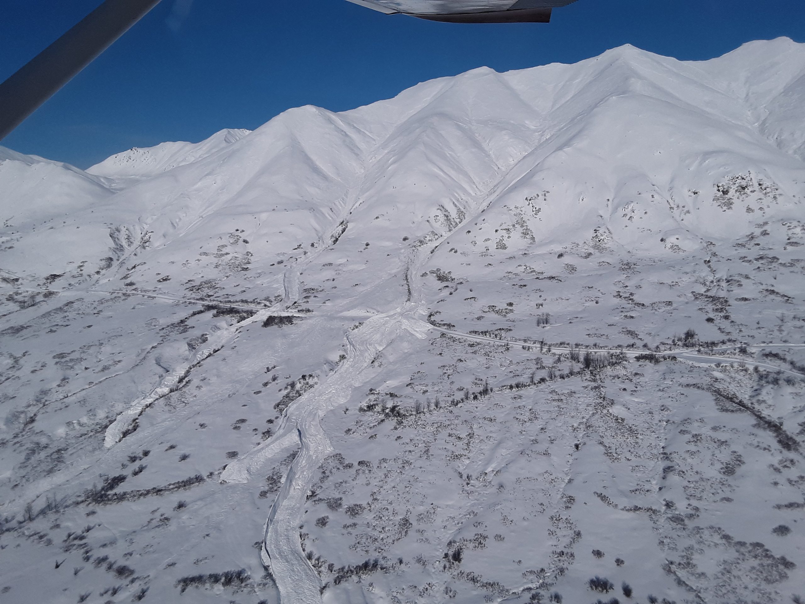
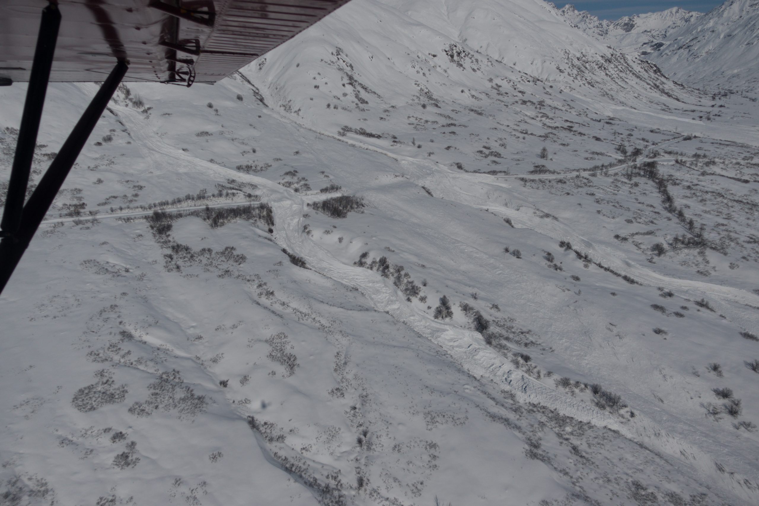
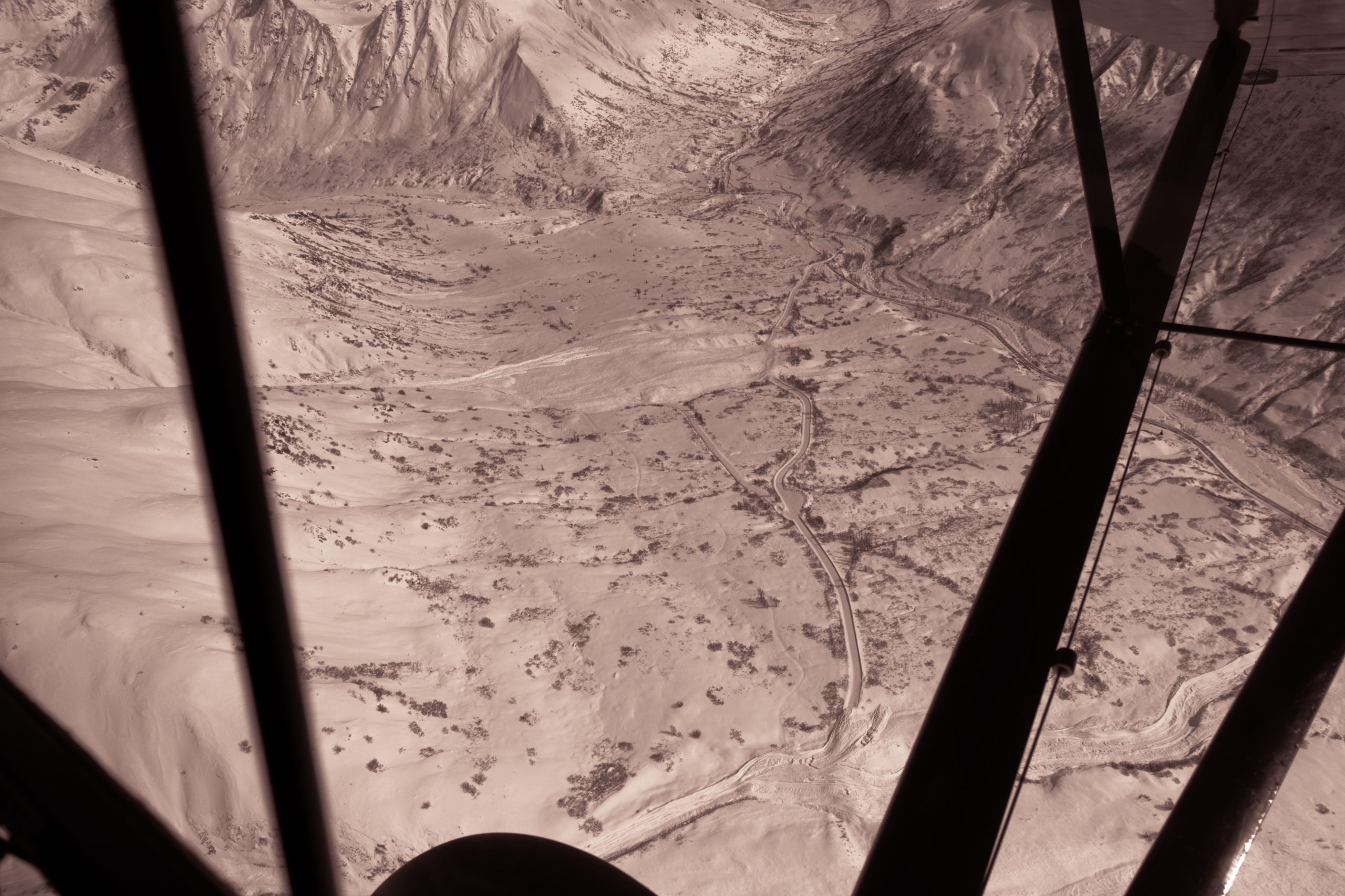
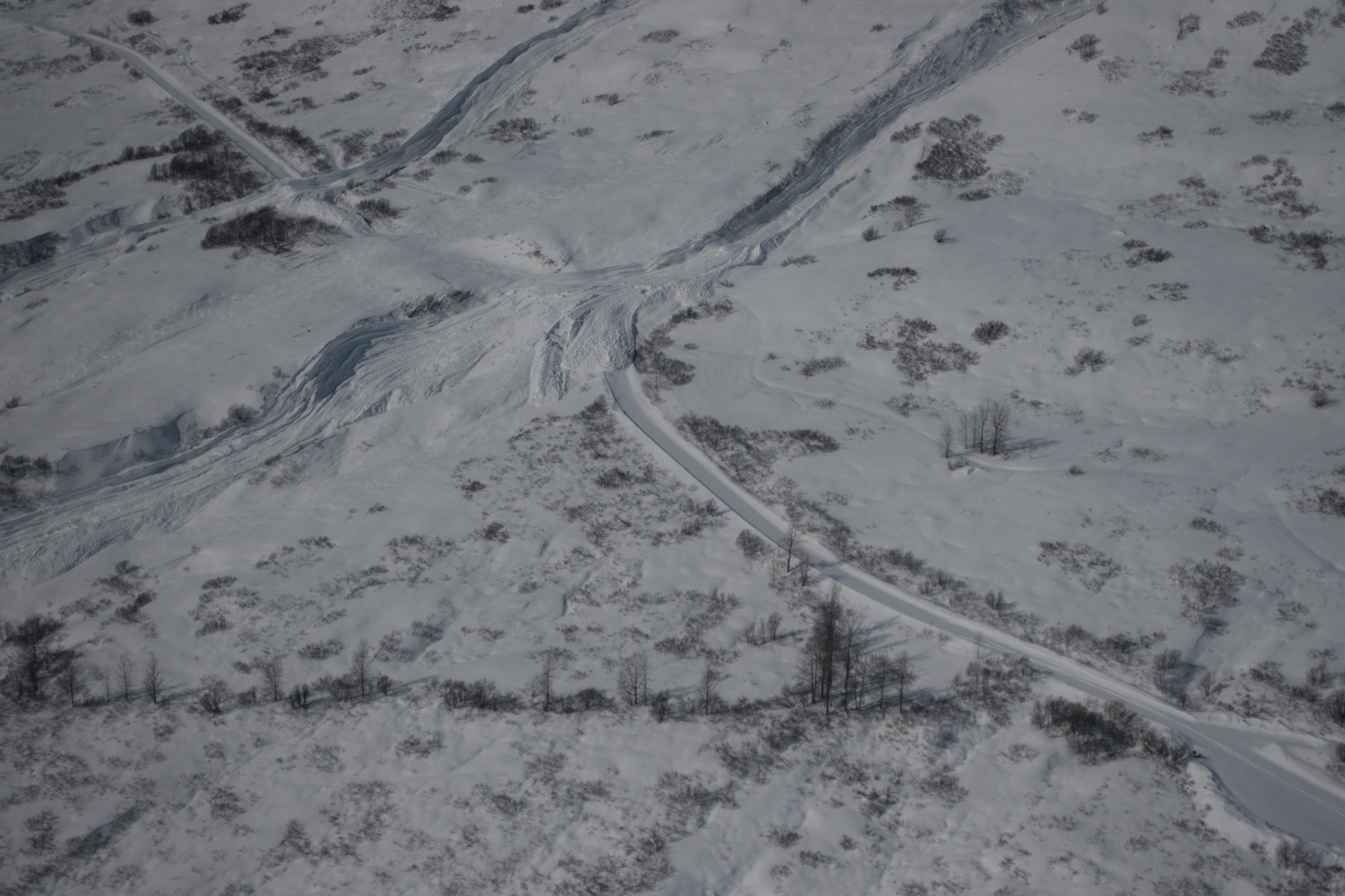
Took a flight over the aftermath of the Easter Avalanche Cycle at HP that occurred 4/4/21. The debris from 5 avalanches on Marmot covered the upper road and the Archangel trailhead with debris 300 yards wide and covering the snogo corridor trail. Debris from 1 avalanche crossed the upper and lower road with 2 of the 5 avalanches almost making it to the lower road. This was a historic avalanche cycle with many D3+ avalanches and many D2’s. DOT says this could be bigger than 1981 when the last avalanche cycle of this size occurred.
Thanks to Neacola Air for the flight today!
Photo credit: HPAC
Avalanche Details
Numerous naturals on mostly E, S, and W aspects with only a few on N.
Many D3's and several D2's.
Most avalanches were storm slabs and wind slabs. Some storm slabs stepped down or pulled out pockets of the persistent slab facet/depth hoar layer. Many avalanches released twice during the storm with most chunky debris occuring after 2:30pm when SWE increased to .1" per hour. This storm brought 11" of snow and 2" of water (SWE).
Obvious signs of instability
| Recent Avalanches? | Yes |
| Collapsing (Whumphing)? | Yes |
| Cracking (Shooting cracks)? | Yes |
Observer Comments
Every RED FLAG existed in the snowpack during this storm and avalanche cycle.
Weather
11" new snow and 2" water (SWE)
temps increased throughout the storm
winds gusting SSW to SSE to W 20-41 mph for 24 hours
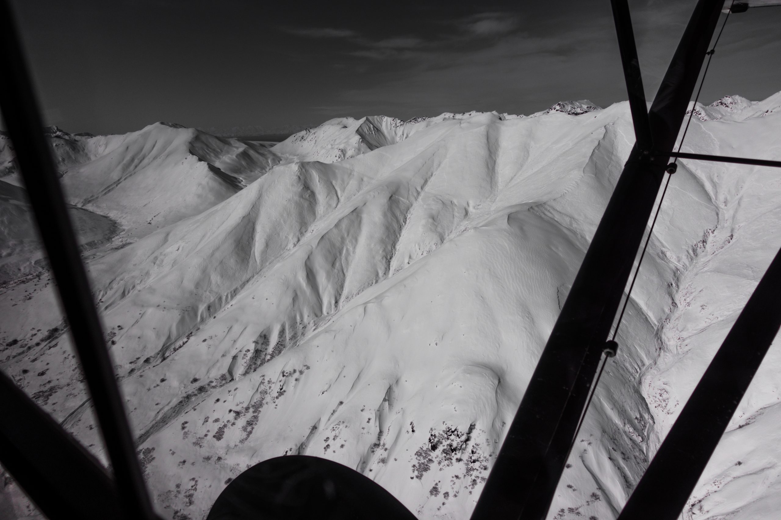
Marmot paths, avalanche debris, Easter Avalanche Cycle. 4/4
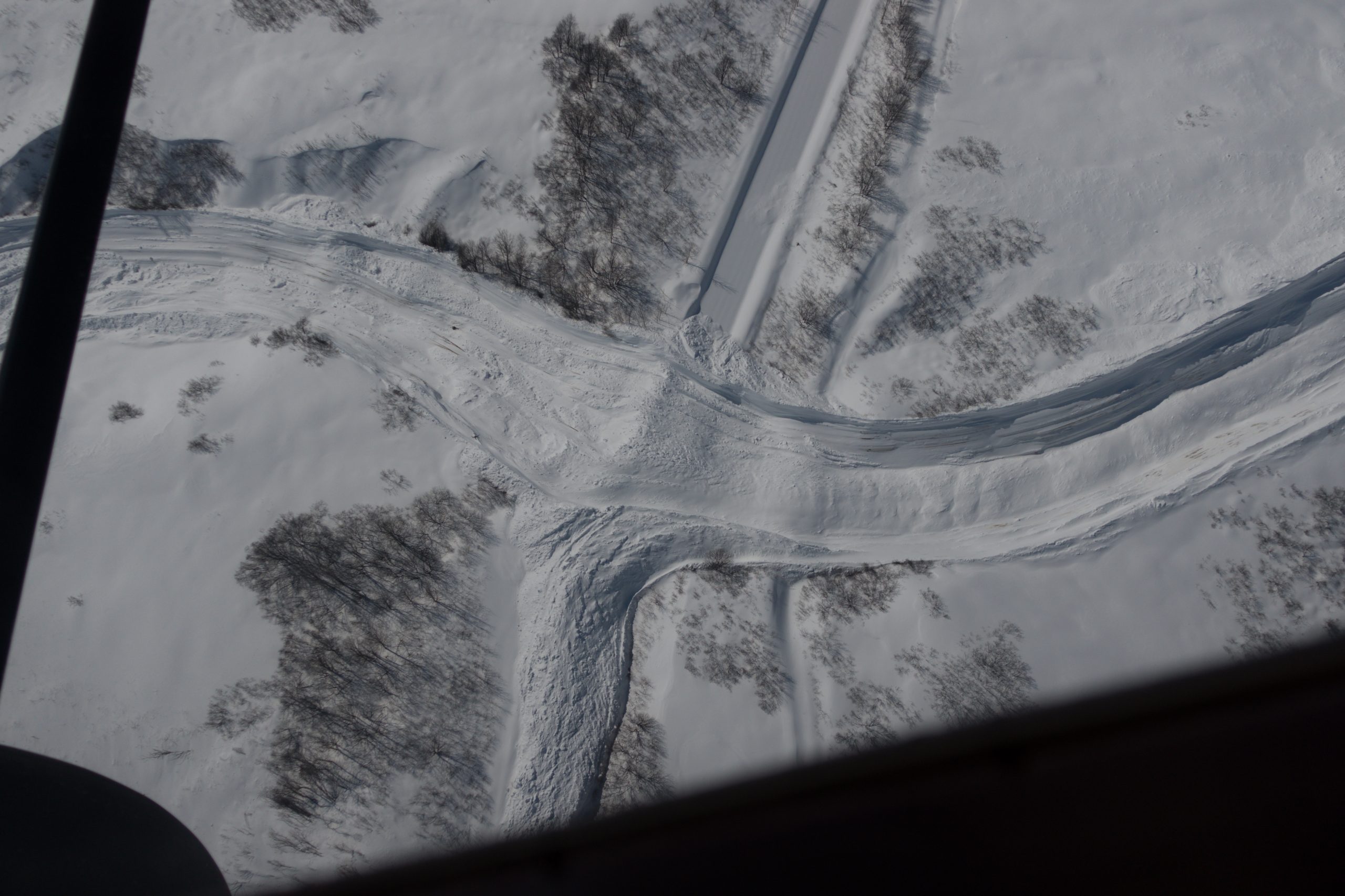
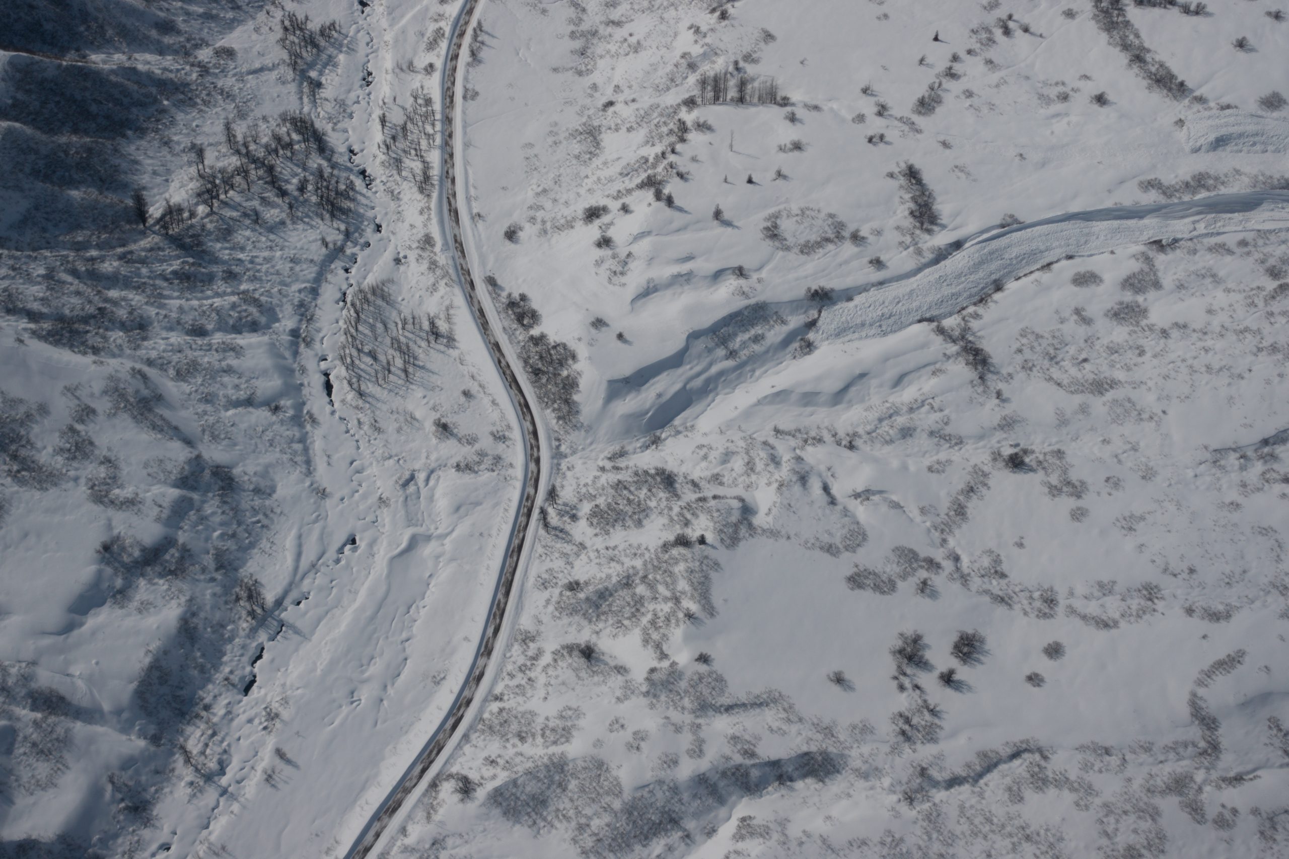
Avalanche debris crosses the road near the road run. 4/4

Avalanche debris from Marmot paths 4/4

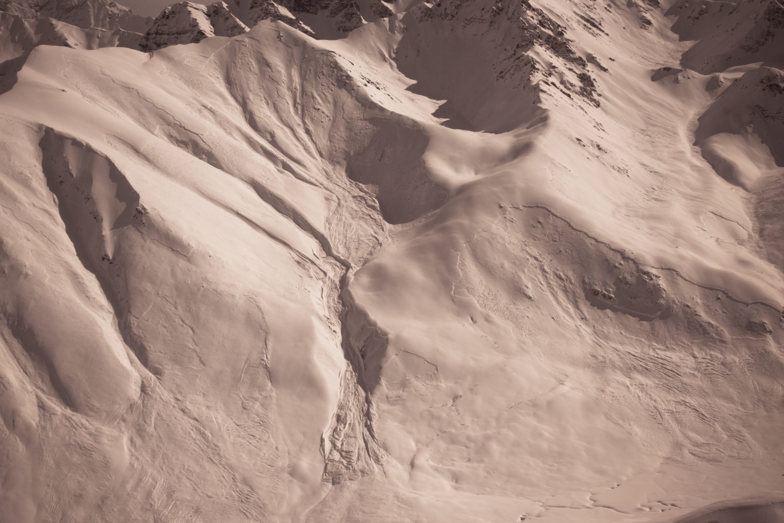
Marmot Archangel path and debris 4/4

Marmot Archangel path slides twice during same storm. 4/4
Large D3.5 hits and crossed Archangel trail, corridor trail, and upper road. 4/4
Avalanches that block the road. 4/4
Marmot avalanche crosses upper road 4/4
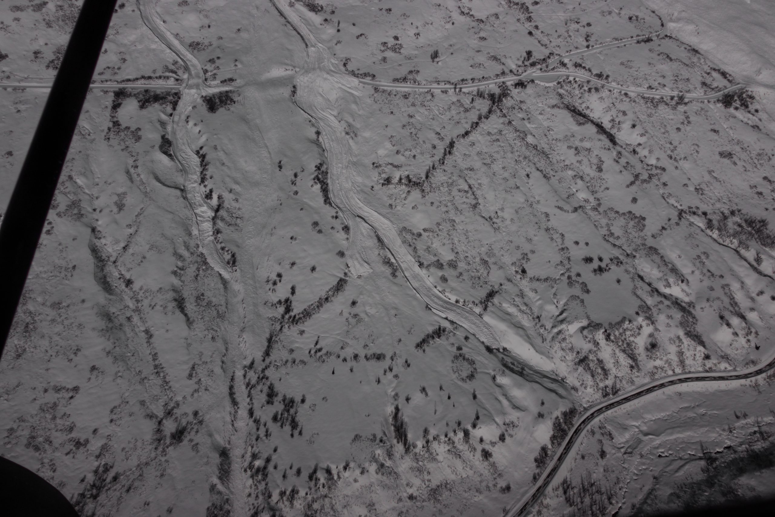
Delia creek up Little Su , Naturals 4/4

Governement NE naturals 4/4
Marmot avalanches and debris that crossed the upper road in two locations. 4/4
Marmot avalanches Easter Avy Cycle 4/4

Marmot Archangel path in the historic Easter Avalanche cycle 4/4

Marmot track and debris crossing the road and heading for the lower road 4/4
Marmot path almost hits the lower road while another path did hit the lower road. 4/4
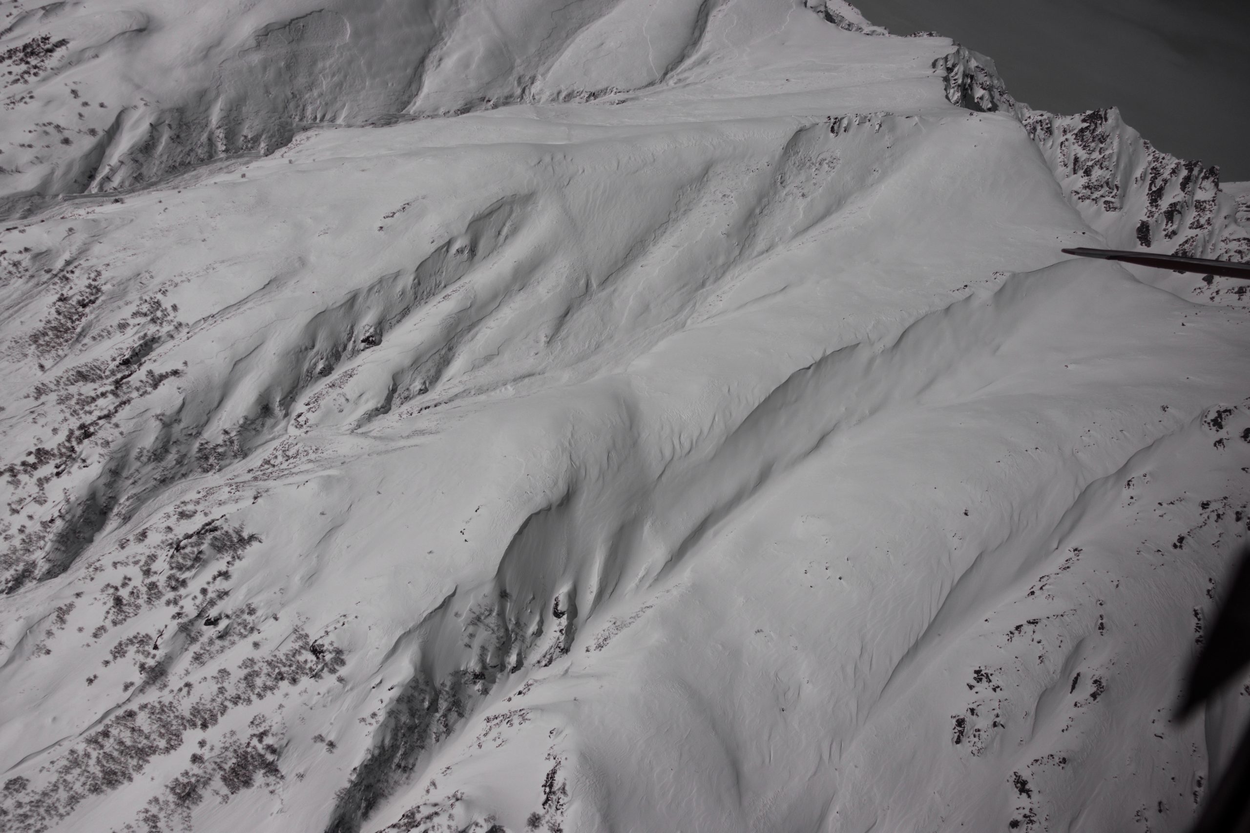
Natural slabs on Marmot sidewalls 4/4

Debris that almost hit the lower road 4/4